|
Advisory
|
Flare Advisory
Valero Refinery in Benicia notified the Air District of ongoing flaring due to a planned shutdown of refinery equipment. Air District inspectors will be closely monitoring. Report air quality complaints: 800-334-ODOR or online.
-
About the Air District
- Advisory Council
- Air District Leadership
- Air District Logos
- Bay Area Clean Air Foundation
- Board of Directors
- Community Advisory Council
- Contracting Opportunities
- Departments
- Diversity Equity and Inclusion
- Enterprise Systems Catalog
- Hearing Board
- History of Air District
- In Your Community
- Job Opportunities
- Mission Statement
- Office of Civil Rights
- Speakers and Tours
- News & Events
- Online Services
- Publications
- Forms
- Public Records
- Contact Us
- Login
- About Air Quality
- Rules & Compliance
-
Permits
- Permit Types and Process
- Permit Applications, Renewals and Forms
- Registrations and Notifications
- Public Notices and Engagement
- Major Facility Review (Title V)
- Permitting Manuals
- Special Programs
- Emissions Banking
- Asbestos Notification / Job #
- Open Burn Notification and Status
- Permit Regulation Changes
- Community Health
- Plans & Climate
- Funding
Alameda County
Learn about Alameda County - its climate, potential air pollution concerns, and current air quality. You can also view upcoming Air District events in Alameda County and read about local efforts to improve air quality.
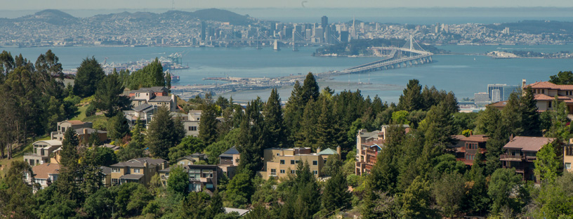
Alameda County lies east of the San Francisco Bay, bounded by Contra Costa Bay to the north, San Joaquin County to the east, and Santa Clara County to the south. Four representatives sit on the Air District’s Board of Directors.
Climate
Along the county’s western coast, temperatures are moderated by the bay, which can act as a heat source during cold weather, or cool the air by evaporation during warm weather. It is generally sunnier farther from the coast, although partly cloudy skies are common throughout the summer. Average summer temperatures are mild overnight and moderate during the day. Winter temperatures are cool overnight and mild during the day. Highest temperatures are more common inland. Wind speeds vary throughout the county, with the strongest gusts along the western coast, often aided by dominant westerly winds and a bay-breeze effect. Rainfall totals average about 14 to 23 inches per year, with the highest totals in the northern end of the county and atop the Oakland-Berkeley hills.
Interactive Air Monitoring Stations Map
Air Quality in Alameda County
Ozone and fine particle pollution, or PM2.5, are the major regional air pollutants of concern in the San Francisco Bay Area. Ozone is primarily a problem in the summer, and fine particle pollution in the winter.
In Alameda County west of the East Bay hills, ozone rarely exceeds health standards because the area is adjacent to San Francisco Bay, which tends to keep temperatures well below prime levels for ozone formation. PM2.5 is a more significant issue in this region due to cool winter nights with light winds, wood smoke, and occasional pollution transport from the Livermore Valley to the east.
Eastern Alameda County has the highest ozone levels in the Bay Area, with summer afternoon temperatures frequently approaching triple digits, spurring ozone levels to exceed health standards. In winter, PM2.5 can be transported westward through the Altamont Pass from the Central Valley where it adds to wood smoke levels, causing health standards to be exceeded.
Last Updated: 4/21/2017