The Air District announced today the appointment of Kimberly Leefatt as the Air District’s civil rights officer, bringing deep experience in environmental law, public agency practice, and environmental justice.
|
Advisory
|
Odor/Flaring Advisory
Valero Refinery in Benicia notified the Air District of continued refinery equipment shutdowns beginning 2/5. Odors and/or flaring may occur. Air District inspectors will be closely monitoring. Report air quality complaints: 800-334-ODOR or online.
-
About the Air District
- Advisory Council
- Air District Leadership
- Air District Logos
- Bay Area Clean Air Foundation
- Board of Directors
- Community Advisory Council
- Contracting Opportunities
- Departments
- Diversity Equity and Inclusion
- Enterprise Systems Catalog
- Hearing Board
- History of Air District
- In Your Community
- Job Opportunities
- Mission Statement
- Office of Civil Rights
- Speakers and Tours
- News & Events
- Online Services
- Publications
- Forms
- Public Records
- Contact Us
- Login
Contra Costa County

Learn about Contra Costa County - its climate, potential air pollution concerns, and current air quality. You can also view upcoming Air District events in Contra Costa County and read about local efforts to improve air quality.
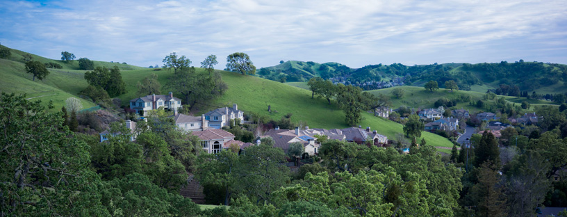
Contra Costa County lies east of the San Pablo Bay, bounded by Alameda County to the south, San Joaquin County to the east, and Solano and Sacramento counties to the north. Four representatives sit on the Air District’s Board of Directors.
-
-
Air District fines BoDean $1.28 million for air quality violationsFebruary 10, 2026
The Air District has fined BoDean Company, Inc. $1.28 million for nine air quality violations at the construction materials company’s Santa Rosa and Windsor facilities.
Learn More -
Spare the Air Alert issued for Thursday due to elevated pollution levelsFebruary 04, 2026
The Air District is issuing a Spare the Air Alert for Thursday, February 5, which bans burning wood, manufactured fire logs or any other solid fuel, both indoors and outdoors.
Learn More -
Air District Board approves new grant program to reinvest penalty funds in impacted communitiesJanuary 29, 2026
The Air District's Board of Directors has approved the grant guidelines for the Local Community Benefits Fund, marking a major milestone for the Bay Reinvesting Penalties for Air Improvement and Resilience program, or Bay REPAIR program. The program will begin accepting grant applications on Jan. 29, 2026, opening a new opportunity for community-led projects that reduce air pollution, improve public health and strengthen community resilience in Benicia, Richmond and surrounding communities.
Learn More -
-
January 20, 2026
-
-
-
Upcoming Events
-
FEB172026
-
FEB182026
-
FEB182026
-
12/30/2025 Air District issues Spare the Air Alert for New Year’s Day. Use of all wood-burning devices is prohibited.
December 30, 2025
-
12/23/2025 Air District has fined Martinez Refining Company and required enhanced air monitoring data transparency
December 23, 2025
-
12/2/2025 Air District fines Chevron $900,000 for air monitoring violations
December 2, 2025
-
11/25/2025 Spare the Air Alerts issued for Wednesday & Thanksgiving Day due to wood smoke pollution. Use of all wood-burning devices is prohibited.
November 25, 2025
-
11/19/2025 Public Comment Deadline – Draft Local Community Benefits Fund Guidelines (Nov 25 at 5 PM)
November 19, 2025
-
11/18/2025 Air District launches commercial electric lawn and garden equipment exchange
November 18, 2025
-
11/13/2025 Air District highlights Bay Area leadership and global collaboration at COP30
November 13, 2025
-
11/5/2025 Air District awards $3 million to deploy new electric vehicle chargers in Richmond
November 5, 2025
-
10/28/2025 Air District fines Republic Services $159,000 for landfill gas violations
October 28, 2025
-
10/27/2025 Air District issues prescribed burn notice for October 27-31
October 27, 2025
-
10/22/2025 Air District awards $5M to electrify special education school buses
October 22, 2025
-
10/17/2025 Air District issues prescribed burn notice for October 17 - 24, 2025
October 17, 2025
-
10/9/2025 Air District fines Marathon Martinez Refinery $372,550 for violations
October 9, 2025
-
10/1/2025 Air District Board adopts wood burning and prescribed burning amendments to protect public health and reduce wildfire risk
October 1, 2025
Climate
Temperatures in and around the San Ramon and Diablo Valleys are warm in the summer and cool in the winter, largely because of their distance from the moderating effect of water bodies and because the California Coast Range blocks marine air flow into the valleys. The Carquinez Strait region remains temperate due to its proximity to water and oceanic air flows. In winter, average daily temperatures are mild, with tule fog common at night. Average summer temperatures are typically mild overnight and warm during the day, with cooler temperatures and stronger winds more common along the western coast. Wind speeds are generally low throughout the region and winds typically blow from northwest to southwest. However, strong afternoon gusts are common in the northern portion of the county around the Carquinez Strait. Annual rainfall averages between 18 and 23 inches across the county.
Interactive Air Monitoring Stations Map
Air Quality in Contra Costa County
Ozone and fine particle pollution, or PM2.5, are the major regional air pollutants of concern in the San Francisco Bay Area. Ozone is primarily a problem in the summer, and fine particle pollution in the winter.
Ozone and PM2.5 infrequently exceed health standards in the portion of Contra Costa County west of the East Bay hills. The San Francisco Bay keeps air temperatures above freezing in winter and well below 100 degrees on even the warmest summer days.
In eastern Contra Costa County, summer afternoon temperatures frequently approach triple digits, spurring ozone levels to exceed health standards. In winter, PM2.5 can be transported westward through the Carquinez Strait from the Central Valley where it adds to wood smoke, causing health standards to be exceeded.
Last Updated: 4/21/2017

