|
Unhealthy air quality due to wildfire smoke. It is illegal to use fireplaces, wood stoves, pellet stoves, outdoor fire pits or other wood-burning devices. |
|
Hindi mabuti sa katawan na kalidad ng hangin dahil sa usok ng wildfire. Ilegal na gumamit ng mga fireplace, wood stove, pellet stove, outdoor na fire pit, o iba oang device sa pagsunog ng kahoy. |
|
Phẩm chất không khí không tốt do khói từ đám cháy rừng. Việc sử dụng lò sưởi, bếp củi, bếp nấu sử dụng viên nén nhiên liệu, lò sưởi ngoài trời hoặc các thiết bị đốt củi khác là bất hợp pháp. |
|
Calidad del aire dañina para la salud debido al humo de incendios forestales. Es ilegal el uso de chimeneas, estufas de leña, estufas de pélets, fogatas en exteriores u otros dispositivos para quemar leña. |
-
About the Air District
- Advisory Council
- Air District Leadership
- Air District Logos
- Bay Area Clean Air Foundation
- Board of Directors
- Community Advisory Council
- Contracting Opportunities
- Departments
- Diversity Equity and Inclusion
- Enterprise Systems Catalog
- Hearing Board
- History of Air District
- In Your Community
- Job Opportunities
- Mission Statement
- Office of Civil Rights
- Speakers and Tours
- News & Events
- Online Services
- Publications
- Forms
- Public Records
- Contact Us
- Login
- About Air Quality
- Rules & Compliance
-
Permits
- Permit Types and Process
- Permit Applications, Renewals and Forms
- Registrations and Notifications
- Public Notices and Engagement
- Major Facility Review (Title V)
- Permitting Manuals
- Special Programs
- Emissions Banking
- Asbestos Notification / Job #
- Open Burn Notification and Status
- Permit Regulation Changes
- Community Health
- Plans & Climate
- Funding
Napa County
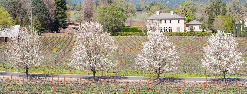
Learn about Napa County - its climate, potential air pollution concerns, and current air quality. You can also view upcoming Air District events in Napa County and read about local efforts to improve air quality.
Napa County is nestled in a valley between the Maycamas Mountains in the west and the Vaca Mountains in the east. One Napa County representative sits on the Air District’s Board of Directors.
Climate
The mountains bordering Napa Valley block much of the prevailing northwesterly winds throughout the year. Sunshine is plentiful in Napa County, and summertime can be very warm in the valley, particularly in the northern end. Winters are usually mild, with cool temperatures overnight and mild-to-moderate temperatures during the day. Wintertime temperatures tend to be slightly cooler in the northern end of the valley. Winds are generally calm throughout the county. Annual precipitation averages range from about 24 inches in low elevations to more than 40 inches in the mountains.
Interactive Air Monitoring Stations Map
Air Quality in Napa County
Ozone and fine particle pollution, or PM2.5, are the major regional air pollutants of concern in the San Francisco Bay Area. Ozone is primarily a problem in the summer, and fine particle pollution in the winter.
In Napa County, ozone rarely exceeds health standards, but PM2.5 occasionally does reach unhealthy concentrations. There are multiple reasons for PM2.5 exceedances in Napa County. First, much of the county is wind-sheltered, which tends to trap PM2.5 within the Napa Valley.
Second, much of the area is well north of the moderating temperatures of San Pablo Bay and, as a result, Napa County experiences some of the coldest nights in the Bay Area. This leads to greater fireplace use and, in turn, higher PM2.5 levels. Finally, in the winter easterly winds often move fine-particle-laden air from the Central Valley to the Carquinez Strait and then into western Solano and southern Napa County.
Last Updated: 4/21/2017