-
About the Air District
- Advisory Council
- Air District Leadership
- Air District Logos
- Bay Area Clean Air Foundation
- Board of Directors
- Community Advisory Council
- Contracting Opportunities
- Departments
- Diversity Equity and Inclusion
- Enterprise Systems Catalog
- Hearing Board
- History of Air District
- In Your Community
- Job Opportunities
- Mission Statement
- Office of Civil Rights
- Speakers and Tours
- News & Events
- Online Services
- Publications
- Forms
- Public Records
- Contact Us
- Login
- About Air Quality
- Rules & Compliance
-
Permits
- Permit Types and Process
- Permit Applications, Renewals and Forms
- Registrations and Notifications
- Public Notices and Engagement
- Major Facility Review (Title V)
- Permitting Manuals
- Special Programs
- Emissions Banking
- Asbestos Notification / Job #
- Open Burn Notification and Status
- Permit Regulation Changes
- Community Health
- Plans & Climate
- Funding
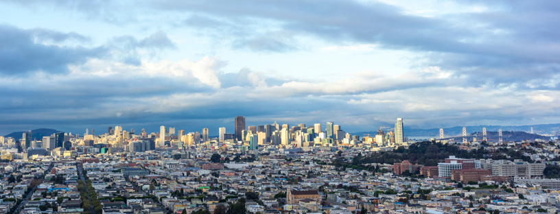
San Francisco County
Learn about San Francisco County - its climate, potential air pollution concerns, and current air quality. You can also view upcoming Air District events in San Francisco County and read about local efforts to improve air quality.
San Francisco County rests at the northern end of the San Francisco Peninsula, bounded by San Mateo County in the south, the Pacific Ocean to the west, San Francisco Bay to the east, and the Golden Gate Bridge to the north. Three San Francisco County representatives sit on the Air District’s Board of Directors.
Climate
Because most of San Francisco's landscape is below 200 feet, the marine layer flows across most of the city, creating a cool and windy climate. The southeastern portion of the county, however, tends to be warmer and sunnier, with fewer foggy days. In the winter, average daily temperatures are mild overnight and moderate during the day, while summertime temperatures tend to remain moderate throughout the season. The highest wind speeds are focused along the western coast and generally mild throughout the county. Rainfall averages about 20 inches per year, with the highest amounts reported on the western coast.
Interactive Air Monitoring Stations Map
Air Quality in San Francisco County
Ozone and fine particle pollution, or PM2.5, are the major regional air pollutants of concern in the San Francisco Bay Area. Ozone is primarily a problem in the summer, and fine particle pollution in the winter.
In San Francisco, ozone almost never exceeds health standards and PM2.5 only exceeds the national standard once or twice each year, generally. Being surrounded by water on three sides keeps temperatures within a narrow range, whereby winter low temperatures rarely reach freezing and summer high temperatures stay well below levels where ozone would form and become unhealthy.
Last Updated: 4/21/2017